


Earlier this year Horizon Imaging was commissioned to photograph the Paynes & Borthwick building development on the River Thames in Greenwich, Central London. Due to the location of the site and the aerial photography tool chosen for the shoot (our unmanned drone), a great deal of planning and paperwork was required to ensure the work could be undertaken in a safe and legal manner – it was certainly not just a case of ‘turn up and fly’!
Firstly, the River Thames is used as a safe transit route for the numerous full-size helicopters which buzz around the capital as it is considered a safe landing area in the event of an engine failure or other emergency. As the drone would be operating in airspace shared with these full-size aircraft, a detailed Safety Case was written and passed to the UK Civil Aviation Authority in order to get clearance for the shoot. The Safety Case detailed maximum heights and distances to which the drone could be flown, and also listed extra safety precautions designed to keep members of the public, users of the river and full-size aircraft operators safe at all times. These precautions included cordoning off surrounding footpaths to stop members of the public straying into the takeoff and landing area for the drone (see below right).
The River Thames is tightly controlled by the Port of London Authority (POLA) who look after every aspect of river use. As the drone would need to fly over the river in order to capture the desired photographs, the permission of the POLA had to be sought before the shoot could go ahead. Various plans were discussed to ensure the photography work had a minimum impact on both our operations and the POLA. This included the suggestion of operating at low tide when water-borne vessels would have to stay far from the riverbank where I would be operating – automatically keeping them a safe distance from the drone.
Finally, the Air Traffic Control tower at the nearby London City Airport was alerted a few days prior to the shoot to make them aware of the planned operations. They said provided the drone was kept below 250 feet it would not be a problem, but they thanked me for contacting them – it’s always better to ask than assume! The Greenwich Met Police were also alerted to the operations in case a member of the public saw the drone, wondered what it was doing and phoned the Police.
For a building in such a challenging location, the Horizon Imaging aerial photography drone was really the only tool suitable for capturing a range of photographs of this building development for the client. Operating this close to the River Thames and full-size helicopter air corridors presented some challenges but by following the regulations of the river and air, the shoot was completed in a safe, legal and timely manner.
This blog post was originally uploaded in January but then removed as the images were not ready for publication – so don’t worry, you’re not seeing double!
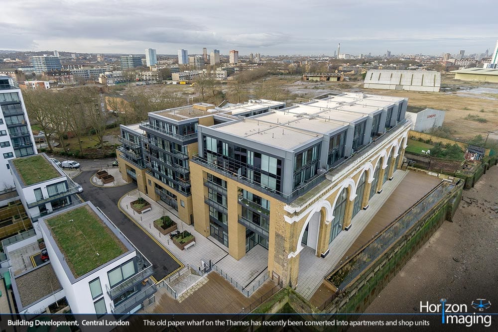
The Paynes & Borthwick development on the River Thames in Greenwich used to be a paper wharf. Click to enlarge.
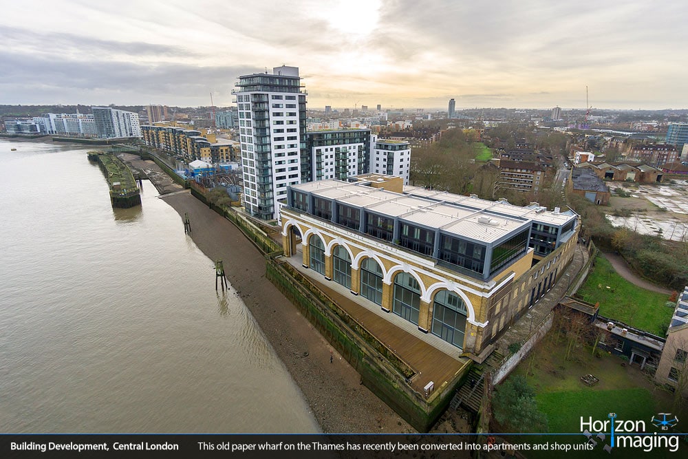
Capturing these aerial photographs required flying over the River Thames and getting permission from the Port of London Authority. Click to enlarge.
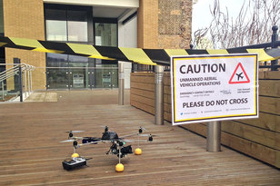
Footpaths around the flying area were cordoned off to prevent members of the public from straying into the takeoff/landing area. Click to enlarge.